Category:Maps of the Southern United States
Jump to navigation
Jump to search
Media in category "Maps of the Southern United States"
The following 135 files are in this category, out of 135 total.
-
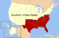
 Map of the Southern United States modern definition.png 566 × 365; 6 KB
-

-
-
 183 of 'The “Beaumont” Geography and Map Tracing Book' (11246644893).jpg 2,440 × 1,648; 809 KB
-
 AfricanAmericanCivlWarMap1.jpg 494 × 293; 58 KB
-
 AlleghanyCountyNC--WhiteheadTwp.PNG 3,300 × 2,550; 54 KB
-
 American south animated map.gif 566 × 365; 32 KB
-
 AsheCountyNC--ChestnutHillTwp.PNG 3,300 × 2,550; 68 KB
-
 AsheCountyNC--CliftonTwp.PNG 3,300 × 2,550; 69 KB
-
 AsheCountyNC--CrestonTwp.PNG 3,300 × 2,550; 68 KB
-
 AsheCountyNC--ElkTwp.PNG 3,300 × 2,550; 68 KB
-
 AsheCountyNC--GrassyCreekTwp.PNG 3,300 × 2,550; 68 KB
-
 AsheCountyNC--HeltonTwp.PNG 3,300 × 2,550; 68 KB
-
 AsheCountyNC--JeffersonTwp.PNG 3,300 × 2,550; 68 KB
-
 BibleBelt.png 572 × 371; 16 KB
-
 BlankMap-USA-South.svg 367 × 343; 32 KB
-
 Carolinas.svg 959 × 593; 90 KB
-
 Coolsouthernstates.gif 570 × 384; 11 KB
-
 Cotton belt.svg 959 × 593; 90 KB
-
 Dixie in America.svg 284 × 184; 93 KB
-
 DurhamCountyNC--CarrTwp.PNG 3,300 × 2,550; 48 KB
-
 DurhamCountyNC--DurhamTwp.PNG 3,300 × 2,550; 48 KB
-
 DurhamCountyNC--LebanonTwp.PNG 3,300 × 2,550; 48 KB
-
 DurhamCountyNC--MangumTwp.PNG 3,300 × 2,550; 48 KB
-
 DurhamCountyNC--OakGroveTwp.PNG 3,300 × 2,550; 48 KB
-
 DurhamCountyNC--TriangleTwp.PNG 3,300 × 2,550; 48 KB
-
 EastSouthCentralStates.png 904 × 593; 23 KB
-
 Essex Skypark-DIR 2011.jpg 600 × 457; 265 KB
-
 February 1971 tornado map.png 2,160 × 1,440; 56 KB
-
 ForsythCountyNC--AbbottsCreekTwp.PNG 3,300 × 2,550; 61 KB
-
 ForsythCountyNC--BelewsCreekTwp.PNG 3,300 × 2,550; 61 KB
-
 ForsythCountyNC--BethaniaTwp.PNG 3,300 × 2,550; 61 KB
-
 ForsythCountyNC--BroadbayTwp.PNG 3,300 × 2,550; 61 KB
-
 ForsythCountyNC--ClemmonsvilleTwp.PNG 3,300 × 2,550; 62 KB
-
 ForsythCountyNC--KernersvilleTwp.PNG 3,300 × 2,550; 61 KB
-
 ForsythCountyNC--LewisvilleTwp.PNG 3,300 × 2,550; 61 KB
-
 ForsythCountyNC--MiddleForkTwp.PNG 3,300 × 2,550; 62 KB
-
 ForsythCountyNC--OldRichmondTwp.PNG 3,300 × 2,550; 61 KB
-
 ForsythCountyNC--OldTownTwp.PNG 3,300 × 2,550; 62 KB
-
 ForsythCountyNC--SalemChapelTwp.PNG 3,300 × 2,550; 62 KB
-
 ForsythCountyNC--SouthForkTwp.PNG 3,300 × 2,550; 62 KB
-
 ForsythCountyNC--ViennaTwp.PNG 3,300 × 2,550; 61 KB
-
 ForsythCountyNC--WinstonTwp.PNG 3,300 × 2,550; 64 KB
-
 Garrison's Map of Dixie.jpg 4,570 × 3,354; 4.3 MB
-
 LLWS South.svg 959 × 593; 113 KB
-
 Lwizyàn-Physical map.GIF 750 × 706; 63 KB
-
 Map from "Letters and notes on the manners..." Vol II Wellcome L0073493.jpg 3,471 × 5,400; 4.98 MB
-
 Map of northern la Florida 1584.png 1,032 × 627; 1.18 MB
-
 Map of USA Deep South.svg 286 × 186; 97 KB
-
 Map of USA highlighting coastal states.png 904 × 593; 25 KB
-
 Map of USA Old South.svg 286 × 186; 100 KB
-
 Map of USA South.svg 512 × 332; 124 KB
-
 Map-USA-South01.png 1,208 × 1,198; 301 KB
-
 Map-USA-South01.svg 744 × 1,052; 349 KB
-
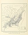
 Maury Geography 056 057 Southern States.jpg 4,147 × 2,054; 1.46 MB
-
 Mississippi Alluvial Plain Level IV ecoregions.pdf 6,652 × 5,260; 9.19 MB
-
 MS-doton-Bond.png 379 × 603; 44 KB
-
 MSMap-doton-Cedarbluff.png 372 × 599; 44 KB
-
 MSMap-doton-McAdams.png 372 × 599; 44 KB
-
 Odum 1936 Southern map.jpg 1,513 × 983; 224 KB
-
 Pin-pen.svg 959 × 593; 224 KB
-
 Reconstruction military districts.svg 959 × 593; 61 KB
-
 RowanCountyNC--AtwellTwp.PNG 3,300 × 2,550; 64 KB
-
 RowanCountyNC--ChinaGroveTwp.PNG 3,300 × 2,550; 64 KB
-
 RowanCountyNC--ClevelandTwp.PNG 3,300 × 2,550; 64 KB
-
 RowanCountyNC--FranklinTwp.PNG 3,300 × 2,550; 64 KB
-
 RowanCountyNC--GoldHillTwp.PNG 3,300 × 2,550; 64 KB
-
 RowanCountyNC--LitakerTwp.PNG 3,300 × 2,550; 64 KB
-
 RowanCountyNC--LockeTwp.PNG 3,300 × 2,550; 64 KB
-
 RowanCountyNC--MorganTwp.PNG 3,300 × 2,550; 64 KB
-
 RowanCountyNC--MountUllaTwp.PNG 3,300 × 2,550; 64 KB
-
 RowanCountyNC--ProvidenceTwp.PNG 3,300 × 2,550; 64 KB
-
 RowanCountyNC--SalisburyTwp.PNG 3,300 × 2,550; 64 KB
-
 RowanCountyNC--ScotchIrishTwp.PNG 3,300 × 2,550; 64 KB
-
 RowanCountyNC--SteeleTwp.PNG 3,300 × 2,550; 64 KB
-
 RowanCountyNC--UnityTwp.PNG 3,300 × 2,550; 64 KB
-
 SlavePopulationUS1860.jpg 10,503 × 8,380; 15.5 MB
-
 Solid South 1880 to 1912.jpg 900 × 524; 278 KB
-
 Sothern States Nl.png 1,264 × 713; 46 KB
-
 SouthAtlanticStates.png 904 × 593; 17 KB
-
 Southern counties with 40 percent African-American population in 2000.png 1,513 × 983; 173 KB
-
 Southern states.png 1,664 × 713; 106 KB
-
 Southern States.png 1,064 × 594; 50 KB
-
 Southern United States by Christopher A. Cooper and H. Gibbs Knotts.png 1,513 × 983; 48 KB
-
 Southern United States Civil War map.png 566 × 365; 6 KB
-
 Southern United States Civil War Map.svg 512 × 332; 123 KB
-
 Southern us block.svg 667 × 452; 4 KB
-
 Southernhouseholdincome.gif 570 × 384; 8 KB
-
 Southernusvotes04.gif 570 × 384; 6 KB
-
 SouthVote.svg 918 × 576; 27 KB
-
 StokesCountyNC--BeaverIslandTwp.PNG 3,300 × 2,550; 60 KB
-
 StokesCountyNC--BigCreekTwp.PNG 3,300 × 2,550; 60 KB
-
 StokesCountyNC--DanburyTwp.PNG 3,300 × 2,550; 60 KB
-
 StokesCountyNC--MeadowsTwp.PNG 3,300 × 2,550; 60 KB
-
 StokesCountyNC--PetersCreekTwp.PNG 3,300 × 2,550; 60 KB
-
 StokesCountyNC--QuakerGapTwp.PNG 3,300 × 2,550; 60 KB
-
 StokesCountyNC--SauratownTwp.PNG 3,300 × 2,550; 60 KB
-
 StokesCountyNC--SnowCreekTwp.PNG 3,300 × 2,550; 60 KB
-
 StokesCountyNC--YadkinTwp.PNG 3,300 × 2,550; 60 KB
-
 SurryCountyNC--DobsonTwp.PNG 1,123 × 794; 16 KB
-
 SurryCountyNC--MountAiryTwp.PNG 1,123 × 794; 16 KB
-
 SurryCountyNC--PilotTwp.PNG 1,123 × 794; 16 KB
-
 SurryCountyNC--ShoalsTwp.PNG 1,123 × 794; 16 KB
-
 SurryCountyNC--SiloamTwp.PNG 1,123 × 794; 16 KB
-
 SurryCountyNC--SouthWestfieldTwp.PNG 1,123 × 794; 16 KB
-
 SurryCountyNC--StewartsCreekTwp.PNG 1,123 × 794; 16 KB
-
 SurryCountyNC--WestfieldTwp.PNG 1,123 × 794; 16 KB
-
 Temp South and Midwest.JPG 461 × 732; 66 KB
-
 The South and Deep South.png 5,400 × 3,586; 1.27 MB
-
 TheSouthUSCB.png 5,285 × 3,762; 1.19 MB
-

-
 TXMap-doton-Gause.png 492 × 446; 9 KB
-
 TXMap-doton-Lohn.png 492 × 446; 9 KB
-
 United States 1860-1870.gif 787 × 483; 49 KB
-
 Upland-South-map.jpg 447 × 291; 75 KB
-
 US map-Arklatex.PNG 572 × 371; 19 KB
-
 US map-Old South.PNG 566 × 365; 6 KB
-
 US Reconstruction military districts.png 531 × 330; 54 KB
-
 Us south census.png 566 × 365; 16 KB
-
 USACE Tenn-Tom project map.png 380 × 474; 34 KB
-
 WestSouthCentralStates.png 904 × 593; 24 KB
-
 Y'allMap.jpg 800 × 495; 71 KB
-
 YadkinCountyNC--BoonvilleTwp.PNG 1,056 × 816; 8 KB
-
 YadkinCountyNC--DeepCreekTwp.PNG 1,056 × 816; 8 KB
-
 YadkinCountyNC--EastBendTwp.PNG 1,056 × 816; 8 KB
-
 YadkinCountyNC--ForbushTwp.PNG 1,056 × 816; 8 KB
-
 YadkinCountyNC--NorthBuckShoalsTwp.PNG 1,056 × 816; 8 KB
-
 YadkinCountyNC--NorthFallCreekTwp.PNG 1,056 × 816; 8 KB
-
 YadkinCountyNC--NorthKnobsTwp.PNG 1,056 × 816; 8 KB
-
 YadkinCountyNC--NorthLibertyTwp.PNG 1,056 × 816; 8 KB
-
 YadkinCountyNC--SouthBuckShoalsTwp.PNG 1,056 × 816; 8 KB
-
 YadkinCountyNC--SouthFallCreekTwp.PNG 1,056 × 816; 8 KB
-
 YadkinCountyNC--SouthKnobsTwp.PNG 1,056 × 816; 8 KB
-
 YadkinCountyNC--SouthLibertyTwp.PNG 1,056 × 816; 8 KB
-
 You all and Y'all.jpg 800 × 495; 73 KB


%27_(11108543603).jpg)
.jpg)


_-_NARA_-_102279776_(page_2).jpg)


